Campsite Availability
8m ago0
Openings Found
2
Dates Tracked
—
Total Sites
Jul 15
—
Full
Jul 16
—
Full
Park Features
2 Backcountry
Group sites available — up to 10 people
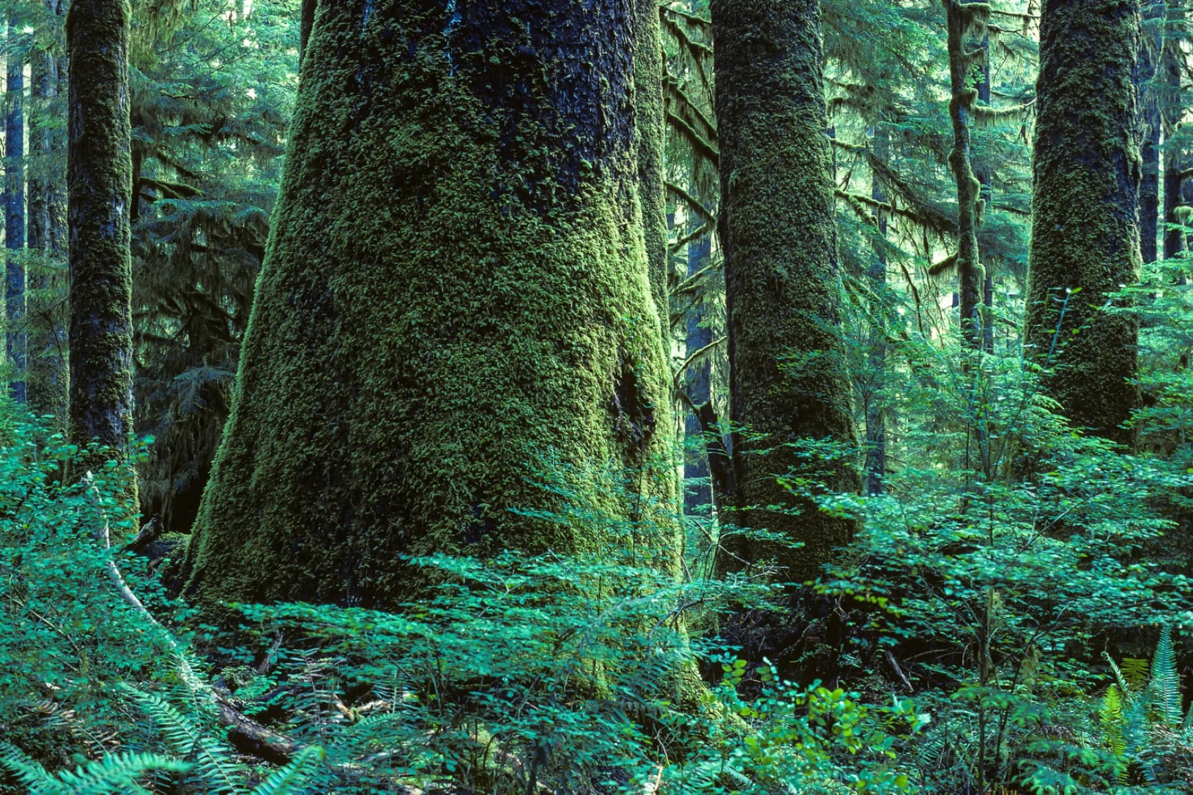
About Carmanah Walbran
Wilderness camping is allowed at several locations upstream from The Three Sisters in the Carmanah Valley, with walk-in camping available above the Valley where the Carmanah Valley Trailhead is located. This is the only area in the park where campfires are permitted. Camping is also permitted during the summer months in the Valley on the Carmanah Creek’s exposed gravel bars. Campfires are prohibited here, and campers are expected to adhere to “Leave No Trace” camping practices. Campsites with tent pads, picnic tables and fire rings are provided beyond the parking area on the service road. Short-term vehicle camping is permitted in the parking lot.
Getting There
Carmanah Walbran Provincial Park is located 20 km northwest of Port Renfrew on the southwestern coast of Vancouver Island. There are three different routes leading to the Caycuse River Bridge, which is the only way to access the park. Visitors traveling from Port Alberni should follow the Bamfield Road for approximately 40 km to the Franklin River Junction. At the junction, turn left onto South Main and proceed eastward, past the logging camp buildings and toward Nitinat Lake. Continue on South Main for approximately 23 km to the Nitinat River Bridge. Stay on South Main until reaching the Caycuse River Bridge. Travelers from Port Renfrew should follow the Lake Cowichan Connector Road north to Honeymoon Bay. At Honeymoon Bay, turn left and proceed along South Shore Road, which becomes Nitinat Main, continuing to the junction of Nitinat Main and South Main. Turn left onto South Main and proceed to the Caycuse River Bridge. Those accessing the park via Lake Cowichan should follow South Shore Road past Gordon Bay Provincial Park to the Nitinat Main, or follow the North Shore Road through Youbou to the Nitinat Main. Continue along Nitinat Main till it connects with Junction South. Turn left onto South Main and proceed to the Caycuse River Bridge. Once you have crossed the Caycuse River Bridge, turn right immediately and proceed on Rosander Main for approximately 29 km to the park. Communities near the park include: Port Renfrew, Port Alberni, Cowichan Lake, Duncan, and Victoria.
Get Directions in Google Maps